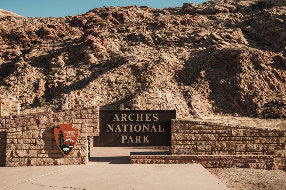
Qinghai Lake (青海湖, Qīnghǎi Hú) is China’s largest lake and the world’s third-largest saline lake at 4,317 square kilometres. It sits at 3,205 metres above sea level on the northeastern edge of the Tibetan Plateau, held in a basin between the Qilian Mountains to the north and the Tibetan highlands to the south. The water is a deep, luminous blue that photographers spend entire careers trying to capture faithfully — and mostly failing, because no screen really conveys how electric the colour is under clear plateau sky.
The lake has become one of China’s most popular cycling destinations. Every July and August, thousands of cyclists from across China arrive to complete the 360-kilometre circuit around the lake. It’s become something of a pilgrimage — the lake road features on many bucket lists, and the route is scenic enough to justify the effort.
Table of contents
Open Table of contents
Why Qinghai Lake is Worth the Effort

Getting to Qinghai Lake requires either flying to Xining and taking a bus or train, or making the overland journey from further afield. It’s not a casual side trip. But the combination of scale (you can see the far shore shimmering 50 kilometres away), altitude-enhanced colours, and the surrounding ecosystem makes it unlike any other lake destination in China.
The lake sits in a protected zone that has recovered significantly over the past two decades after serious water level declines in the 1980s and 90s. Conservation efforts have rebuilt bird populations, and the area around Bird Island now hosts hundreds of thousands of migratory birds in spring. The lake level has risen about 4 metres since 2004, and the ecosystem is measurably healthier.
Outside the summer cycling and birdwatching peak, Qinghai Lake in winter becomes a frozen expanse visited by bar-headed geese and occasionally wolves. The winter landscape is dramatic and far less crowded, though facilities are reduced.
When to Go
May–June: Rapeseed flowers bloom in yellow fields between the road and the lake shore — the visual contrast with the blue water and snow mountains behind is extraordinary. Bird Island is active with nesting cormorants, brown-headed gulls, and bar-headed geese. Weather can be cold (nighttime temperatures still below 10°C) and changeable.
July–August: Peak season. The Qinghai Lake Cycling Race happens in July, and recreational cyclists flood the road. Accommodation fills up and prices spike. Days are long and warm (15–22°C), but afternoon thunderstorms are common on the plateau.
September–October: Crowds thin out sharply. The landscape turns golden and brown. Temperatures drop quickly — below zero at night by October. Migratory birds begin moving through again. This is arguably the best time for photography.
November–April: The lake may partially freeze. Very few visitors, limited transport, some facilities closed. Cold and harsh but genuinely beautiful if you’re equipped.
Getting There
From Xining: Qinghai Lake is 150km west of Xining. The most convenient access is by bus from Xining South Bus Station (西宁南客运站) to Heimahe (黑马河) or Erlangjian (二郎剑), which are the two main visitor areas on the south shore. Buses run approximately hourly during peak season, less frequently off-season. Journey time about 2.5–3 hours. Fare around ¥40–55.
By train: The Xining-Golmud railway passes along the north shore of the lake. Getting off at Heimahe station or the less-used Shadao station requires advance planning as not all trains stop and the stations are several kilometres from the visitor areas. Train is not the practical choice for most visitors.
Private car or rental: The most flexible option. Xining has car rental agencies. The lake circuit road (Route 227 and Route 315) is good quality and well-signed. Allow a full day for the circuit drive, or two days if you want to stop seriously at multiple points.
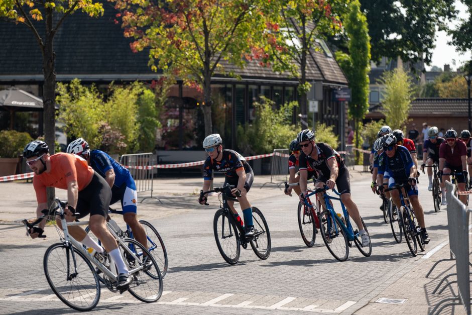
The Cycling Circuit
The 360-kilometre full circuit around the lake takes most cyclists 3–4 days, depending on fitness and how much time you spend at stops. The road is paved throughout and has dedicated cycling lanes on much of the southern section.
Clockwise from Erlangjian (二郎剑): Most cyclists start here on the south shore near the main visitor area. The scenery is best on the south shore and west shore. Heimahe on the southwest is a popular first night stop (~100km). The west shore passes through Tibetan villages with yaks grazing in grassland. The north shore is longer and less scenic — a mix of farmland and small towns. Completing at Erlangjian or continuing to Xining if you’ve arranged transport.
Bicycle rental: Available in Xining for ¥80–150/day for decent bikes, or from the Erlangjian visitor area for slightly higher prices. Bring your own if you’re serious — the rental bikes are adequate but not impressive.
Key points on the route:
- Erlangjian Scenic Area (二郎剑): Main entrance to the south shore, with jetties, viewing platforms, and the most photographed straight section of road running alongside the water
- Heimahe (黑马河): Best sunrise viewing point, with the road running perfectly east and the sun rising over the water. Many cyclists plan to be here at 5am
- Bird Island (鸟岛, Niǎo Dǎo): Now connected to the shore by a land bridge due to water level rise, but still called an island. Nesting season April–June has the highest bird concentrations
Bird Island & Wildlife
Bird Island Scenic Area (¥80 entrance) is about 30km west of the main Erlangjian entrance. The island hosts China’s largest freshwater bird breeding colony — up to 100,000 birds including bar-headed geese, brown-headed gulls, and cormorants. In peak season (May–June), the noise and visual density of nesting birds is genuinely overwhelming.
Outside nesting season, the area still has significant bird populations — the lake is an important stopover on Central Asian flyways. Winter brings occasional raptors and the plateau foxes and wolves that follow prey along the shoreline.
The lake’s protected zone also contains Przewalski’s gazelle, a critically endangered species with one of its last viable populations in the grasslands north of the lake. Numbers have recovered from under 300 in the 1990s to over 3,000 now. You might spot them in the grassland areas north of the shore road.
Accommodation
Options cluster at Erlangjian and Heimahe. Expect basic but clean guesthouses and mid-range hotels rather than luxury.
Erlangjian area: The widest range of accommodation, from budget guesthouses at ¥80–120/night to mid-range hotels at ¥200–350/night. Quality varies — read recent reviews carefully. Some places cater almost exclusively to cycling tour groups.
Heimahe village: Smaller selection, mostly guesthouses run by local Tibetan families. More atmospheric but less comfortable. Prices similar at budget end. The advantage is you’re positioned for the sunrise without needing to move.
Camping: Permitted in designated areas with a permit. Self-sufficient camping is possible in the grassland areas away from the core scenic zones, but facilities are obviously zero and nights get very cold even in summer.
Entrance Fees & Scenic Areas
Erlangjian Scenic Area: ¥80 (includes access to the shore area and several viewing platforms)
Bird Island: ¥80
Heimahe sunrise viewing area: ¥30
Sand Island (沙岛): ¥80 (a sand bar area on the east shore with sandboarding)
Note: You don’t need to buy entrance tickets to cycle the road around the lake — the fees are for the formal scenic areas with facilities. The public road around the lake is free to use.
Altitude & Health
At 3,200+ metres, Qinghai Lake will affect many visitors. The symptoms of altitude adjustment — mild headaches, slight fatigue, occasional breathlessness — are less severe than at Lhasa (3,650m) but still real. Most people feel normal within 24–48 hours.
Practical measures: Arrive in Xining (2,275m) at least one night before heading to the lake. Avoid strenuous exertion on the first day. Stay well hydrated. Avoid alcohol for the first 24 hours. If you’re cycling, start slowly and be honest about how you feel.
Altitude medication (acetazolamide/Diamox) is available in Xining pharmacies and is worth considering if you have a history of altitude sensitivity.
What to Eat
The area around the lake is Tibetan and Hui Muslim cultural territory. Lamb is the dominant protein — roasted, braised, or in noodle soups.
Heimahe’s lamb hot pot is locally famous. Village guesthouses will often prepare it for dinner if you ask ahead. Expect to pay ¥50–80/person for a generous meal.
Noodle shops along the route serve filling bowls for ¥15–25. Hand-pulled beef noodles (a Qinghai variation on Lanzhou-style) are everywhere.
Yogurt: The plateau dairy tradition means thick, rich yogurt is sold at roadside stalls. Mixed with Tibetan barley sugar (青稞糖), it’s an energy-dense snack that’s popular with cyclists.
Practical Tips
- Buy supplies in Xining before heading out. Village shops stock basics but selection is limited and prices are higher.
- Layer clothing: Even in July, morning and evening temperatures at the lake can be 10–15°C lower than midday. A down jacket for evenings is not excessive.
- Phone signal: Reasonable coverage along the south shore road. Diminishes on the north shore and away from villages.
- Sunscreen: Plateau UV radiation is severe. Factor 50+ and reapplication every 2 hours is not overcautious.
- Photography: The best light is 1–2 hours after sunrise and 1–2 hours before sunset. The midday light at altitude is harsh and washes out the water colour.
- Altitude permits: No special permits required for Qinghai Lake. Tibet entry permits are needed for the Tibetan Autonomous Region proper, but Qinghai province (where the lake is located) does not require them.